Photographs of a couple of bridges on the Beachburg Sub near Fitzroy Harbour.
The Beachburg Sub ran from Ottawa to Brent in Algonquin Park. It was abandoned in sections from 1996, the section from Ottawa (Nepean Junction) to Portage du Fort being abandoned in 20131.
Mile Post (MP) distances are from Hurdman Junction.
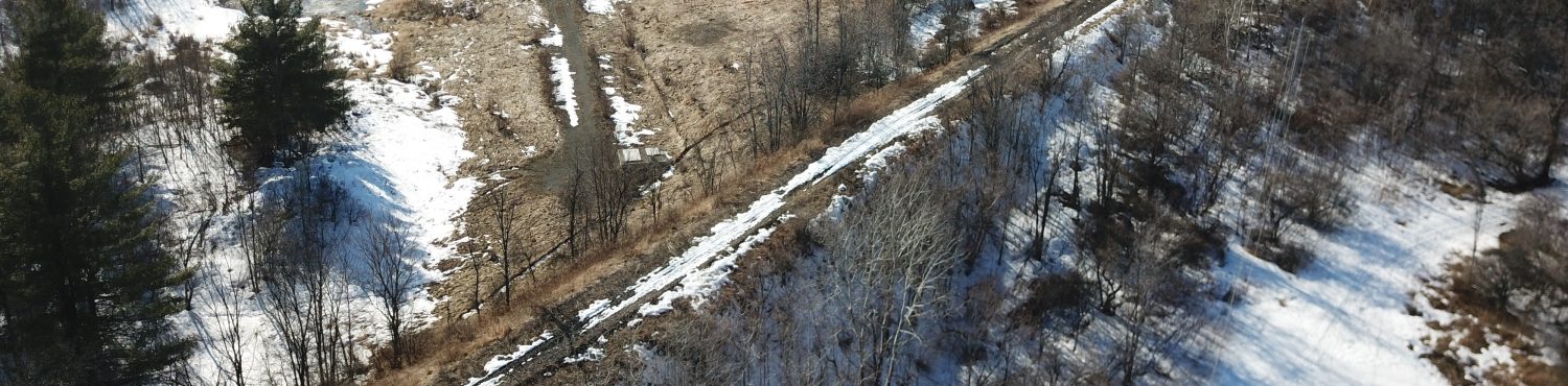
MP 34.0 mi
This is an 83 m 3-span semi-through plate girder bridge. The middle span, being longer, has higher I-beams, with the height rolling from the outer to the inner in a pleasing curve, which is also reflected at the ends of the bridge. Form definitely follows function, but it’s nice when aesthetic details are also given a nod.
I had noted this bridge based on tracing the line in Google Earth, but did not realize how easy it was to get to. You can park at the end of Old Pakenham Rd. and then walk 150 m on a path to the bridge.
It’s seldom that easy. Sometimes you slog through kilometres of bush to try to find something you’ve seen on Google Earth and end up finding nothing. Other times (such as this), you take an easy stroll and find something spectacular!
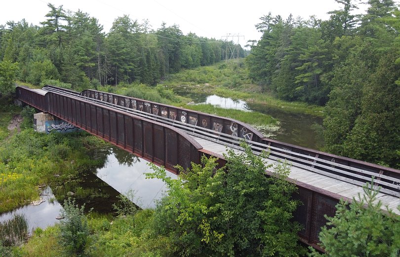
MP 37.8 mi
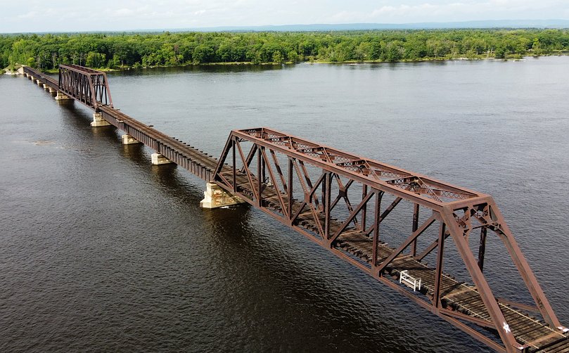
At this MP the Beachburg Sub crossed from Ontario to Quebec over the Ottawa River on a 485 m multi-span bridge. Of the twelve spans, ten are deck plate girder spans with an average length of 34 m. The other two are truss spans of 61 m and 89 m. I guess the truss spans are over deeper channels (making it harder to place piers with the same spacing), and the higher clearance perhaps better allows for boat traffic.
I parked at the end of Morris Island Dr., as the end of Loggers Way has “No Trespassing” signs between the end of the road and the railway right-of-way. There was a well-worn path through the woods to the right-of-way. The Google Earth imagery lead me to believe that the bridge would be blocked off, but in fact there were just some mounds of dirt and concrete blocks which one can easily walk over/around. For some reason I decided it would be advantageous to go out onto the bridge just short of the first truss span to get my aerial shots. In retrospect, it would have been easier to stay on shore!
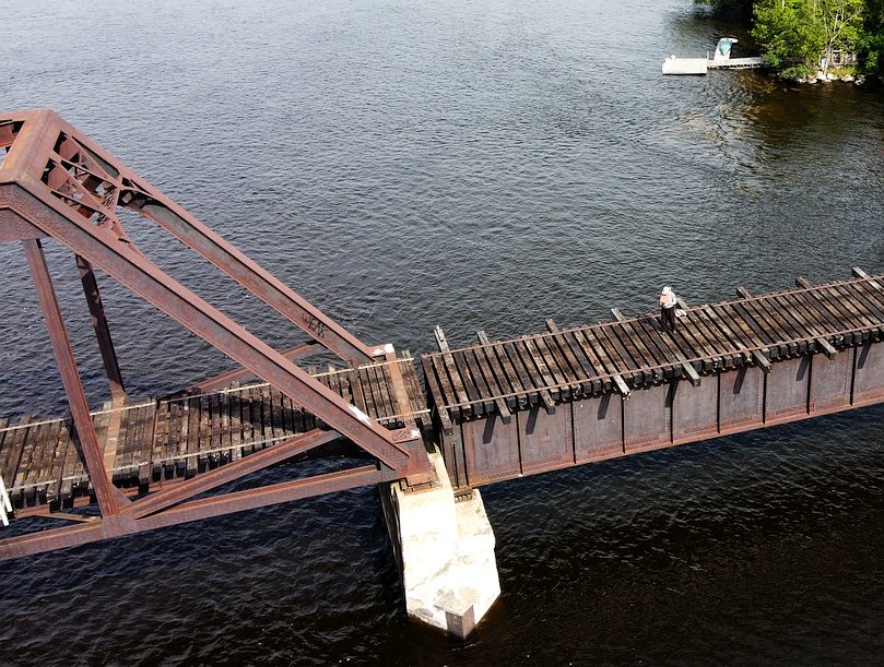
This is an interesting photo. It is not nearly as unnerving as it might seem from this shot. Although there are no railings, the bridge is wide enough you never need to go near the edges.
In fact, my main worry was dropping something and having it roll into a crack between the ties. I had with me the drone ($800), a tablet to view the downlink ($500) and a camera ($800). I also feared landing the drone near one of the cracks and having it topple into the drink. So I hand-caught it instead. First time I’d done it with this drone (have done it with others in the past), but it turned out to be easy.
When I got home Ginger said, “why didn’t you just fly from shore instead of going out on the bridge?” Now, why didn’t I think of that!?