This is a post about the Canadian Pacific (CP) Sainte Agathe Subdivision (Laurentian Division), affectionately known as the “P’tit Train du Nord”. This post focuses on the abandoned section, from from Saint-Jérôme, QC (45°46’24.6″N, 73°59’57.2″W) to Mont-Laurier, QC (46°33’31.4″N, 75°29’18″W). I have complied this information mainly in preparation for a trip we are planning along the route.
Stations
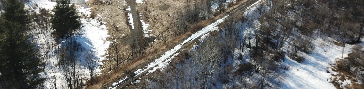
The Canadian Pacific (CP) Sainte Agathe Subdivision (Laurentian Division) ran from Windsor Station in Montréal to Mont-Laurier, QC. The section to Saint-Jérôme is now a commuter line. Passenger service ended north of Saint-Jérôme in 1981, and the rails were lifted in 19901. It was converted to a rail-trail or “linear park” in 19962.
There are a surprising number of stations still surviving on the right-of-way, reflecting, I would guess, it’s relatively late abandonment and the importance of tourism to the area. Most are “in situ”, with the exception of the station at Mont-Tremblant Village, which was rebuilt in 19983, and St. Jovite, which was moved5.
The following table shows the stops on this section, as shown in the three sources listed in note 6, below. More notes, links to information and photos, and references follow the table.
| Stn. No.1 | Station name(s) (community name) 2 3 4 | Mile No. | Location5 | Sources6 |
|---|---|---|---|---|
| 2546 | St. Jérôme | 33.1 | 45°46’36.0″N,74°0’1.6″W | 256 |
| 2548 | Paquin | 6 | ||
| 2549 | Lesage | 41.0 | 45°51’46.3″N,74°4’4.2″W | 26 |
| 2550 | Shawbridge (Prévost) | 41.8 | 45°52’21.9″N,74°4’31.6″W | 256 |
| 2553 | Piedmont | 46.0 | 45°54’29.0″N,74°8’11.1″W | 256 |
| 2554 | Mont Rolland / Ste. Adèle (Sainte-Adèle) | 49.0 | 45°56’22.7″N,74°7’10.6″W | 26 |
| 2555 | Ste. Marguerite Pit | 6 | ||
| 2556 | Ste. Marguerite (Sainte-Marguerite-Station) | 53.6 | 45°59’18.7″N,74°7’6.9″W | 256 |
| 2557 | Val Morin | 57.3 | 46°0’39.2″N,74°10’23.5″W | 26 |
| 2558 | Val David / Belisles Mill (Val David) | 59.5 | 46°1’50.4″N,74°12’25.8″W | 26 |
| 2559 | Prefontaine | 62.0 | 46°2’46.8″N,74°15’1.9″W | 26 |
| 2560 | Ste. Agathe (Sainte-Agathe-des-Monts) | 63.7 | 46°3’6.8″N,74°16’57.1″W | 256 |
| 2561 | B.A. Oil | 6 | ||
| 2562 | Ivry | 67.4 | 46°5’1.6″N,74°20’10.0″W | 26 |
| Degrosbois | 69.0 | 46°5’49.7″N,74°21’39.2″W | 2 | |
| 2564 | Nantel | 71.5 | 46°6’19.4″N,74°24’16.7″W | 26 |
| Labargo Mill | 73.3 | 46°7’6.4″N,74°25’47.8″W | 2 | |
| 2565 | Summit | 6 | ||
| 2566 | St. Faustin (Saint-Faustin-Lac-Carré) | 77.0 | 46°07’45.7″N,74°28’16.3″W | 256 |
| 2568 | Morrison | 80.5 | 46°6’46.3″N,74°30’58.2″W | 26 |
| 2570 | St. Jovite (moved) | 85.0 | 46°7’51.3″N,74°35’28.3″W | 256 |
| 2573 | Mont Tremblant / Lac Mercier (Mont-Tremblant Village) (rebuilt) | 90.5 | 46°11’40.0″N,74°37’52.5″W | 256 |
| Conception (La Conception-Station) | 93.7 | 46°12’13.0″N,74°41’6.2″W | 2 | |
| 2575 | Labelle (Village de Labelle) | 100.1 | 46°17’0.0″N,74°44’3.0″W | 256 |
| 2576 | Daoust | 6 | ||
| 2577 | Macaza | 105.3 | 46°20’24.9″N,74°46’58.5″W | 26 |
| 2578 | Lac Castor | 6 | ||
| 2580 | Annonciation (Rivière-Rouge) | 113.2 | 46°24’55.0″N,74°52’17.6″W | 26 |
| 2581 | Lacoste | 116.7 | 46°26’43.8″N,74°55’30.3″W | 26 |
| 2583 | Bellerive (Bellerive-sur-le-Lac) | 121.7 | 46°23’46.8″N,74°59’19.5″W | 26 |
| 2584 | Nominingue | 123.6 | 46°23’39.4″N,75°1’40.0″W | 256 |
| Loranger | 127.3 | 46°25’50.0″N,75°4’23.3″W | 2 | |
| 2588 | Lac Saguay / Hebert (Lac Saguay) | 134.5 | 46°29’58.7″N,75°8’56.8″W | 26 |
| 2590 | Guénette | 142.8 | 46°31’8.3″N,75°15’42.3″W | 26 |
| 2593 | Barrette (Val-Barrette) | 149.6 | 46°30’28.4″N,75°21’21.3″W | 26 |
| 2594 | Val Rock Ltd. M.130.8 | 6 | ||
| 2595 | Mont Laurier | 158.1 | 46°33’24.3″N,75°29’25.1″W | 256 |
Notes
1 Station numbers are from the “Canadian Pacific list of Designating Numbers of Stations, 1966” (see below)
2 Station names in bold are surviving stations (Mont-Tremblant Village rebuilt3, St. Jovite moved5)
3 Station names separated by “/” appear as different names in different sources
4 Community names are in parentheses, if different from the station name
5 Locations for stations that no longer exist are taken from the Mile No.’s along the route (calibrated by surviving stations) and thus should be considered approximate
6 Sources are as follows:
2 = 1920 Official Guide, retrieved from: http://www.quebecgenweb.com/~qclauren/trains.htm (scroll down to “Labelle”)
5 = 1950 Official Guide, author collection
6 = “Canadian Pacific list of Designating Numbers of Stations, 1966”, retrieved from: https://open.library.ubc.ca/collections/chung/chungtext/items/1.0226344
Discussion
The table was compiled mainly from the three sources listed in note 6, above. This post is a gathering-together of some information I have found through on-line research (i.e. nothing new here that you couldn’t get for yourself with a few dozen hours’ research).
Below are references and links to information and photos organized by station (with general information on the line at the start). If a station’s name is missing, I have no information on it.
Linear Park & General Info
- GenWeb des Laurentides, La région regroupe les anciens comtés de Argenteuil, Deux-Montagnes, Labelle et Terrebonne (scroll down to “Labelle” for entry from the 1920 Official Guide used as one of my references)
- Laurentian Heritage WebMagazine, Railways, Stations, and Linear Parks, Part 1 and Part 2
- Les vieilles gares du Québec (scroll down to “Laurentides”)
- Patrimoine culturel de la MRC d’Antoine-Labelle, Le métier de chef de gare (PDF)
- Out There, P’tit Train du Nord
- Route des Belles-Histoires
- GrandQuebec.com, Parc linéaire Le P’tit Train du Nord
Saint-Jérôme
- Ville de Saint-Jérôme, Bureau d’accueil touristique
- Les vieilles gares du Québec, Gare de Saint-Jérôme
- Route des Belles-Histoires, Gare de Saint-Jérôme
- Photos: 1
Shawbridge (Prévost)
- Les vieilles gares du Québec, Gare de Prévost
- Route des Belles-Histoires, Gare de Prévost
- La gare de Prévost (dans les Laurentides, Québec)
- Musée Virtuel de Prévost, Gare du C.P. de Shawbridge
Piedmont
- Photos: 1
Mont Rolland / Ste. Adèle (Sainte-Adèle)
- Les vieilles gares du Québec, Gare de Mont-Rolland
- Route des Belles-Histoires, Gare de Mont-Rolland
- Photos: 1
Ste. Marguerite (Sainte-Marguerite-Station)
- Photos: 1
Val Morin
- Les vieilles gares du Québec, Gare de Val-Morin
- Route des Belles-Histoires, Gare de Val-Morin
Val David / Belisles Mill
- Route des Belles-Histoires, Gare de Val-David
- Photos: 1
Ste. Agathe (Sainte-Agathe-des-Monts)
- Les vieilles gares du Québec, Gare de Sainte-Agathe
- Route des Belles-Histoires, Gare de Sainte-Agathe-des-Monts
- Chanbre de Commerce du Grand Sainte-Agathe, Bureau d’information touristique de Sainte-Agathe-des-Monts
- Photos: 1
St. Faustin (Saint-Faustin-Lac-Carré)
- Les vieilles gares du Québec, Gare de Saint-Faustin
- Route des Belles-Histoires, Gare de Saint-Faustin-Lac-Carré
- Photos: 1 2
St. Jovite
Moved5 to 855 rue de Saint-Jovite (46°7’6.2″N,74°35’30.5″W)
- Old Canadian Train Stations – Quebec (scroll down to “St-Jovite Station”)
- Les vieilles gares du Québec, Gare de Saint-Jovite
- Antipasto Restaurant (in former Saint-Jovite station)
- Photos: 1 2 3
Mont Tremblant / Lac Mercier (Mont-Tremblant Village)
Rebuilt 19983 as an exact replica4.
- Ville de Mont-Tremblant, Place de la Gare
- The train station, heart of the village (PDF)
- officialmonttremblant.com, Old Tremblant Village
- Route des Belles-Histoires, Le Village Gare de Mont-Tremblant
- Photos: 1 2 3 4
Labelle (Village de Labelle)
- Les vieilles gares du Québec, Gare de Labelle
- Route des Belles-Histoires, Musée ferroviaire, Gare de Labelle
- La Municipalité de Labelle, Musée ferroviaire gare de Labelle
- Radio Canada International, Historic train station restored as resto/inn
- Quebec Railway Postcards (Scroll down to “Labelle, Quebec.”)
- Photos: 1 2 3 4
Annonciation (Rivière-Rouge)
- Les vieilles gares du Québec, Gare de L’Annonciation
- Route des Belles-Histoires, Gare patrimoniale de L’Annonciation
- https://www.laurentides.com/en/belleshistoires-route/60
- Photos: 1
Nominingue
- Les vieilles gares du Québec, Gare de Nominingue
- GrandQuebec.com, Gare de Nominingue
- Nominingue, Au coeur des Hautes-Laurentides, Place de la gare
- Route des Belles-Histoires, Gare patrimoniale de Nominingue
- Photos: 1
Lac Saguay / Hebert (Lac Saguay)
Mont Laurier
- Les vieilles gares du Québec, Gare de Mont-Laurier
- Route des Belles-Histoires, Gare patrimoniale de Mont-Laurier et Parc linéaire «Le P’tit Train du Nord»
- Photos: 1 2 3
References
1 Laurentian Heritage WebMagazine, Railways, Stations, and Linear Parks, Part 1
2 Laurentian Heritage WebMagazine, Railways, Stations, and Linear Parks, Part 2
3 The train station, heart of the village (PDF file)
4 officialmonttremblant.com, Old Tremblant Village
5 Old Canadian Train Stations – Quebec
Other links
Quebec Train Stations (note loads of links at bottom of page!)
Canadian Pacific Railway, Right-of-Way Department fonds